Antonella Radicchi

Antonella Radicchi

Architect and Urbanist, PhD

PLACEMAKING

Screenshot 2023-11-30 at 23.26.40 Screenshot 2023-11-30 at 23.26.13 Screenshot 2023-11-30 at 23.26.57 Screenshot 2023-11-30 at 23.27.25 Screenshot 2023-11-30 at 23.27.36 Screenshot 2023-11-30 at 23.27.51 Screenshot 2023-11-30 at 23.28.00

DESCRIPTION

Module: BNV7142 Placemaking
Module Leader: Dr Antonella Radicchi, Senior Lecturer in Urban Planning and Sustainability, Birmingham City University Department for the Built Environment
Academic Year 2022/23 Semester 1 (3h/w)

Module Concept

Placemaking is a holistic and global concept that applies to built and natural environments, and it is central to successful spatial planning. It is a collaborative process which unfolds through situated social practices across different spatial and temporal scales to transform spaces into socially inclusive, sustainable and liveable places.

In this module, students developed spatial planning skills through engagement with the ideas about the creation and management of ‘place’ by working on a real-life case study in Port Loop, Birmingham.

Acting as a planning consultancy, they re-imagined the Port Loop site and transformed it into a socially inclusive, sustainable and liveable place, applying a participatory approach and working in collaboration with the project partner, Civic Square, and the local community living in the neighbourhood.

Key tasks included:

  • the development of a concept for a Port Loop Public Space Action Plan that should have its core in the factory of Port Loop and connect it to the public spaces of the site and its surroundings
  • design a placemaking intervention for one of the public spaces of the Port Loop Public Space Action Plan
  • ideation and implementation of a participatory methodology via interviews with the project partner Civic Square and key stakeholders/community representatives and an online survey with the local community
  • Incorporate the community’s feedback, visions, needs and hopes into the final project proposal

YEAR

Fall Semester 2022

PARTNERS

Birmingham City University, Department for the Built Environment
Project Partner: CIVIC  SQUARE

DIGITAL CITIES

joshua-sortino-LqKhnDzSF-8-unsplash
Image by Joshua Sortino via unsplash
<Cover and above image respectively by Michael Dziedzic and Joshua Sortino via unsplash>

DESCRIPTION

Module: BNV5147 Digital Cities
Module Leader: Dr Antonella Radicchi, Senior Lecturer in Urban Planning and Sustainability, Birmingham City University Department for the Built Environment
Academic Year 2022/23 Semester 2 (4h/w)

Technology is the answer, but what was the question? Cedric Price

Module Concept

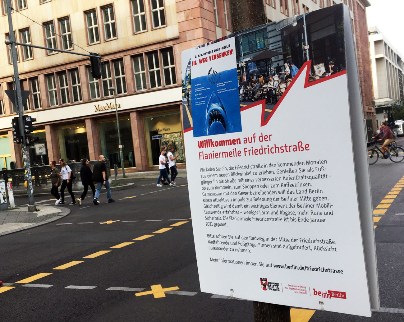
Since the 1970s the concept of the digital city has been widely discussed in academic, artistic, societal and political contexts under different labels such as the city of bits, e-topia, smart city, and intelligent city to name but a few. More recently, with the application of digitisation and digitalization to the planning process, the debate about the impact of digital technology on urban contexts has regained momentum with an emphasis on aspects of e.g., democracy, governance, participation, ethics, justice, analysis and visualization tools, city planning and design outcomes, climate change and planetary health.

According to the literature, the digital city can be meant as an umbrella term which includes urban concepts characterized by the intersection of three features: the physical elements of the urban context, the social communities and the digital technological infrastructures mainly represented by Information Communication Technologies. A scrutiny of projects and studies about digital technology and digital cities shows the complexity of this umbrella urban concept. On the one hand, the digital city promises to deliver new efficiencies, improve quality of life, boost the economy, enhance democratic communication and even solve climate and environmental crises. On the other hand, the digital city is often underpinned by top-down, technocratic, a-historical, a-political and a-contextual approaches which can even exacerbate forms of spatial, social, economic and environmental injustice.

To address these issues, critics of the digital city suggest alternative theoretical and methodological approaches which should re-centre the discourse around the meaning and purpose of digital technology and re-question the vision of the city and the values underpinning the digital city in light of the current climate, environmental, societal, democratic, energy and economic crises.

Against this backdrop, in this Module we took a critical stance to study the theory & practice of digital cities, drawing on a humanist perspective on knowledge for urban planning.

Specifically, we questioned the implications and impacts of the digital city in three main areas:
• Urban governance (e.g., digital planning, digitization and digitalization of data & procedure, participation, digital surveillance, algorithmic planning)
• Urban analysis and representation (e.g., big data, digital and other twins, mobile apps and digital maps)
• Urban design and planning (e.g., smart neighbourhoods, digital tech solutions applied to mobility, green, artificial light etc).

During the Module, students were invited to reflect upon key questions central to the critical debate on the digital city, e.g., what is the meaning and purpose of digital technology? What is our vision of the digital city? What are the values that should nurture the vision of the digital city in terms of urbs and civitas? For whom and by whom should the digital city be imagined and developed? How are public participation, public spaces and urban commons framed by the digital city? What is the ecological footprint of the digital city? What are the challenges and opportunities of digital technology and digital cities in light of the current climate, environmental, societal, democratic, energy and economic crises?

To address these questions and critically study the theory & practice of digital cities, students were supported by four major learning means which constitute the core of the Module’s Teaching and Learning Plan:

  • The Digital Cities Lecture Series Spring 2023: weekly guest lectures with national and international guest speakers from industry and academia who will present the state of the art of research and practice on digital cities.
  • The Board of Bits: weekly interactive sessions discussing key readings, digital technology, case studies and novel ideas about digital cities, led by the Module Leader.
  • Individual Reflective Essays to identify and discuss opportunities, challenges and potential solutions that digital technology & digital cities can present to the future of the planning profession, drawing on real-life case studies.
  • A planning-based project to re-imagine an assigned site in Birmingham, in line with the students’ vision and values of their Digital City.


YEAR

Spring Semester 2023

PARTNERS

Birmingham City University, Department for the Built Environment
Module Tutor: Milad Mohtadi, Technician in Digital Technologies, BCU
Project Partner: Harry Conway, Senior Technician Immersive Media, STEAMhouse

Project Partner: Holly Williams, Town Planner, Craig Rowbottom, Associate Town Planner and Matthew Davis, Senior Landscape Architect, @ ARUP Birmingham

IS BERLIN A WALKABLE CITY?

1599px-Cityscape_Berlin
Figure above: Cityscape of Berlin. Image source: Wikimedia Commons, Ph.  Thomas Wolf  CC License.

DESCRIPTION

Project studio: B5 Bachelor Auftragsprojekt “Is Berlin a Walkable City?”
TU Berlin, Institute of Urban and Regional Planning | Winter Semester 2020/2021 & 2021/2022 | online / onsite course (4h/w)
Instructor: Dr. Arch. Antonella Radicchi

In the XX century, high-speed transport and the quest for efficiency degraded the walkable city. Hazardous high-speed traffic broke up the fine-grained pedestrian network and imposed barriers to free movement on foot. In forgoing the pedestrian experience, the street lost its intimate scale and transparency and became a mere service road, devoid of public life. In the 1960s and 1970s, people started reclaiming the streets, demanding more public space, as was the emblematic case in the Village, NYC. More recently, in the past few decades, the knowledge of the social, environmental, economic and political benefits associated with walking has motivated European policy-makers and municipal planners to employ sustainable policies and design interventions for creating pedestrian-friendly environments. Such efforts have ranged from complete pedestrianisation and permanently or temporarily closure of streets to traffic to encouraging a symbiotic relationship of multiple transportation modes. In Berlin, such as in Paris, Barcelona, Milan and other European cities, soft and pedestrian mobility is gaining momentum. Specifically, the Municipality of Berlin has taken action to create pedestrian-friendly environments by implementing a planning strategy grounded on four pillars:

1. The Mobility Act, with a new branch focusing on pedestrian mobility;
2. The development of “pedestrian-friendly neighbourhoods”;
3. The creation of safe crossing;
4. The improvement of accessibility for pedestrians.

Against this backdrop, these research-informed project studio courses aim to investigate whether and to which extent this planning strategy is progressing towards the goal of making Berlin a walkable city, by working on the following case studies:

  • Assessment and redesign of the area Uhlandstr./Mecklenburgische Str. to favour the walkable connection between the two sections of the Volkspark Wilmersdorf.
  • Assessment of the “Pedestrian-friendly Shopping Street” concept implemented in Friedrichstr. in Mitte Friedrichstr.
  • Formulation of design guidelines for a walkable Berlin, combining the research findings from the other case studies with the knowledge from international best practices.
  • Creation of an online StoryMap (and a related descriptive database) illustrating the permanent and temporary pedestrian-friendly projects in Berlin implemented by the Berlin Municipality and community groups.

For the investigation of these case studies, a definition of “walkable city” will be provided by the students and used as a lens through which to analyse the case studies. The students will be required to organise themselves in small working groups, select a case study among the three proposed, choose the research methods, manage the workload for the analysis and assessment of the case studies, present the progress work during the course of the semester by means of presentations and report the results of their work in the final outputs of the project studio courses.

A broad range of research methods can be applied for the investigation of the case studies such as review and content analysis of literature and policy documents, media and press scanning, interviews with stakeholders and local residents, statistics, spatial analysis, behavioural and mind mapping, sensory ethnographic methods (such as senses walks), multimodal tools (e.g., combining audio, visual and text content).

YEAR

Winter Semester 2020/2021, 2021/2022

PARTNERS

TU Berlin, Institute of Urban and Regional Planning.
Project Partners from the Berlin Municipality (in alphabetical order): Jörg Kaptain Senatsverwaltung für Umwelt, Verkehr und Klimaschutz; Saskia Leckel, Senatsverwaltung für Umwelt, Verkehr und Klimaschutz, Arbeitsgruppe Fußverkehrsinfrastruktur; Dan Orbeck Senatsverwaltung für Umwelt, Verkehr und Klimaschutz, Gruppenleiter „Fußverkehrsinfrastruktur“.
Guest critics in the AY 2021/2022 (in alphabetical order): Prof. Em. Dr. Dietrich Henckel, TU Berlin, Prof. Dr. Antje Michel, Fachhochschule Potsdam, Prof. Dr. Rolf Monheim, Universität Bayreuth, Ing. Ricarda Pätzold, Deutsches Institut für Urbanistik.

SUSTAINABILITY AND…

COVER-SOSE2020-© Dilara Ünlüel 2020
Figure above: Nature and the City. Pictures taken in Berlin by the student Dilara Ünlüel © 2020

DESCRIPTION

Seminar: M 6.2 Ökonomie der Stadterneuerung: “Sustainability and Urban Renewal” 
TU Berlin, Institute of City and Regional Planning | Summer Semester 2020 & 2021 | online course (2h/w)
Instructor: Dr. Arch. Antonella Radicchi

Currently, there is a growing concern with regard to health and supporting concepts like sustainability, liveability and well-being in science, economy, policy, and planning. More than ever before, those themes are dominating programs of major cities and governments, recently in line with the UN Sustainable Development Goals. These programmes have in common a renovated interest in the “public space agenda”. Hereby, public spaces are considered as key ingredients for creating more socially, economically and ecologically responsible and sustainable cities. Apart from that, there is also increased attention in supra-national organizations (e.g. World Health Organization, European Commission) and their pertinent agendas (e.g. the 7th EC Environmental Action Programme) to align to global challenges of the SDGs and find solutions. Accordingly, a majority of European cities are now implementing policies for sustainable urban planning and design, where aspects of their environmental performance are under particular scrutiny.
Against this backdrop, the aim of this course is to critically reflect on the current debate on Sustainable Cities, by looking at the interface of policy/practice so to assess how sustainability policies have been implemented through urban renewal projects. Berlin will be taken as a case study city and the UN Sustainable Development Goal no. 3 Good Health and Well-Being and no. 11 Sustainable Cities and Communities as a reference. Public spaces will act as a reference spatial framework for the development of this study. Policies and urban renewal projects will be presented, addressing four increasingly relevant themes, i.e. urban noise and quiet areas; nature and the city; artificial light and the urban night; and walkable cities. Students will be encouraged to use neighbourhoods where they live as case studies for the development of the individual fieldwork exercises.

YEAR

Summer Semester 2020, 2021

PARTNER

TU Berlin, Institute of Urban and Regional Planning

LIGHT- & SOUNDSCAPES

Final-Posters_1 Final-Posters_2 Final-Posters_3

DESCRIPTION

Soundscapes and Lightscapes of the Urban Night. Berlin/Florence
Quietness and natural darkness are becoming ever-scarcer goods in cities, especially at night. Therefore, cities have been developing policies and strategies to reduce and mitigate the impact of light and noise pollution at night on human health, quality of life and wellbeing of citizens. Nevertheless, light and sound are rather more complex and ambivalent issues to deal with. Noise, as the negative side of sound, is definetely present in urban planning, as it is the case of light with its positive attributes, even if to a lesser extent. Vice versa, the positive side of sound is much less investigated, as are the negative aspects of artificial light. Moreover, sound and light have in common that they both have quantitative features – such as sound pressure levels and lighting levels – and qualitative ones, which are mediated by individual perception. However, the lack of methods to evaluate the impact on citizen perception in everyday life and the lack of integrated approaches to city pollution are still considered as demanding issues.

Against this background, the “Soundscapes and Lightscapes of the Night. Berlin/Florence” project aimed to fill this gap of methodological knowledge proposing a new experimental, integrated approach to the issues of light and noise pollution at night, through a comparative pilot study conducted in the cities of Berlin and Florence.
In the pilot study, we experimented with a mixed approach, integrating qualitative and quantitative methods. First, we made combined light- and soundwalks in the pilot study areas in Berlin and Florence – a combination, which had not yet been performed, as far as we know. Whereas soundwalks have a rather long history with a consistent body of literature and examples of practices, lightwalks are a much younger phenomenon. Therefore, theory and practice of soundwalking was taken as a reference for defining the new method of light- and soundwalk. Based on the experiences of these combined walks, in the pilot study areas four hot spots were identified where further qualitative analyses were undertaken, such as experimental measurements of sound and light levels, and surveys with passers-by in the street. An extensive analysis of the respective policies and political and legal frameworks in both cities were also conducted by the means of literature review and expert interviews.

The results show very remarkable differences between both cities and prove the great potential of an integrated analysis of quantitative and qualitative data, especially by taking citizen perception into account. These potentials warrant further research.

YEAR

2016-2017

ACKNOWLEDGMENTS

This project was developed in the Fall Semester  2016/2017 with and by the students from the Technical University of Berlin in the frame of the program: Masterprojekt Stadt- und Regionalplanung.
Supervisors: Prof. Dr. Dietrich Henckel (Technical University of Berlin), Dr. Arch. Antonella Radicchi (Technical University of Berlin).
Students: Elena Abt, Hanna Buntz, Jeffrey del Castillo, Rocío Gravino, Anna Loffing, Tim Lukas Lübben, Luisa Multer, Johannes Sichter, Luca Steffhan, Federico Trípoli, Christiane Wichtmann.
The project was awarded the TU Berlin Quality of the Students’ Work (2nd placement). Download the certificate here.

MAPPING OPEN SOUNDSCAPES

DESCRIPTION

Lorenzo de’ Medici Institute, Architecture & Interior Design Department (Graduate)

The workshop focused on analysing relationships between Florentine soundscapes and emotional dimensions perceived by city users, and therefore on investigating the role played by the sonic environment in shaping the identity of cities. Students were given an introductory lesson on the disciplinary field of Soundscape Studies and qualitative tools of analysing and mapping urban soundscapes. The case study of Firenze Sound Map and its linking to the OpenData System of the Municipality of Firenze were illustrated; finally introductory notes on the concept of open data were provided. A soundwalk was guided in the city; students were asked to collect data (sounds, picturess, comments) which were selected and uploaded to Firenze Sound Map and shared with the OpenData System of the Municipality of Firenze.

YEAR

2014, Fall

CLIENT

Lorenzo de’ Medici Institute

EMOTIONAL MAPPING

Mappa_RadioTenera-LOW Mappa_TeneraQR-LOW Mappa_TeneraSonora-LOW Mappa_TestaccioSoundMap-LOW

DESCRIPTION

University of Roma Tre (IT), Faculty of Architecture (Graduate)

The course provided an understanding of the method of analysing, representing and designing the city grounded on the so-called sensory approach, which mainly focuses on sensorial and intangible aspects of the urban realm. The core product of the class was the study of the sensorial and intangible aspects that characterize the Testaccio-Porta Portese-Ostiense area in Rome and their representation via a “tender” map, referring to the Emotional Geography (which, in the words of Giuliana Bruno, “includes the beings that inhabit it and the forms of the passing through spaces, including the spaces of life”). Students were asked to apply qualitative methods of analysis and representation of the urban realm, not limiting to localization, spatial distribution and quantification of data, but attempting an understanding of the everyday life through the senses.

YEAR

2012-2013

CLIENT

University of Roma Tre

READING CITIES

1 1_1 2 8 7

DESCRIPTION

Kent State University, College of Architecture & Environmental Design, Florence Program (Undergraduate)

The course aimed to promote critical thinking about the disciplines and activities that shape our environment. The combination of informative lectures by the instructor – both in present and historical terms, readings and fieldtrips as well as personal research and analysis, aimed to generate a common cultural ground and supporting the development of the student work. The goal was to equip students with the necessary tools to describe, represent and analyse the built environment, in the form of cities under investigation. Cities selected for study and on-site visits include Rome, Siena, Milan, Verona, Vicenza, Venice. The core product of the class was the sketchbook.

YEAR

2012 – 2013

CLIENT

Kent State University